Department of Geosciences
Department of Geosciences Idaho State University Home Page

Main PageResearchTeachingCurriculum VitaePhotosTeamLab

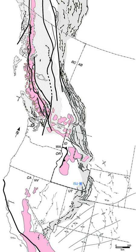
U.S. Northern Rocky Mountains Research

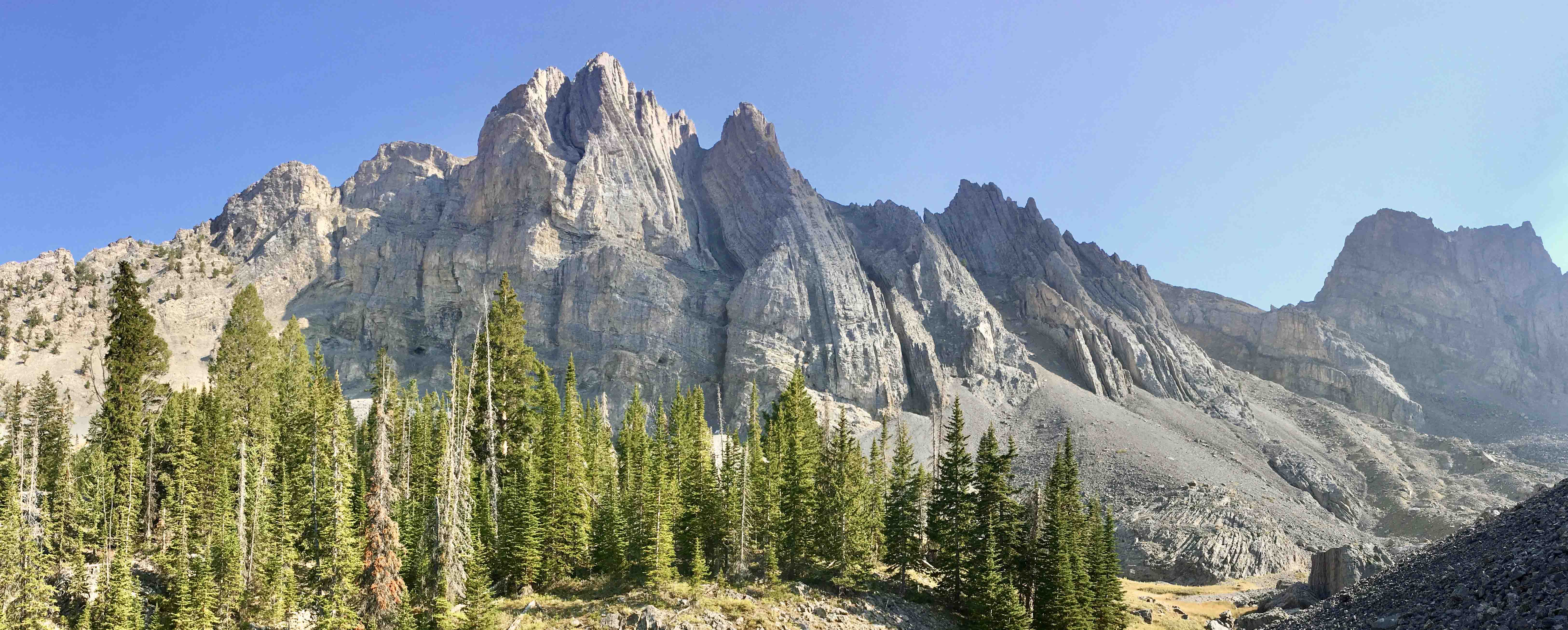
Spectacular folded limestones of the Mississippian Scott Peak Formation in the Lost River Range, east-central Idaho.

LRFS-view

  • Idaho, Montana, and the surrounding northern U.S. Rocky Mountains encompass diverse geology and is ideally situated to investigate the eroded remnants of a major Jurassic to Cretaceous ocean-continent subduction system and its subsequent Cenozoic collapse. Additional opportunities abound to explore the Archean to Paleozoic framework within which this orogen was constructed. Ongoing research is mainly focused on constraining the evolution of the Jurassic to Cretaceous fold-thrust belt and extension that immediately followed crustal thickening.


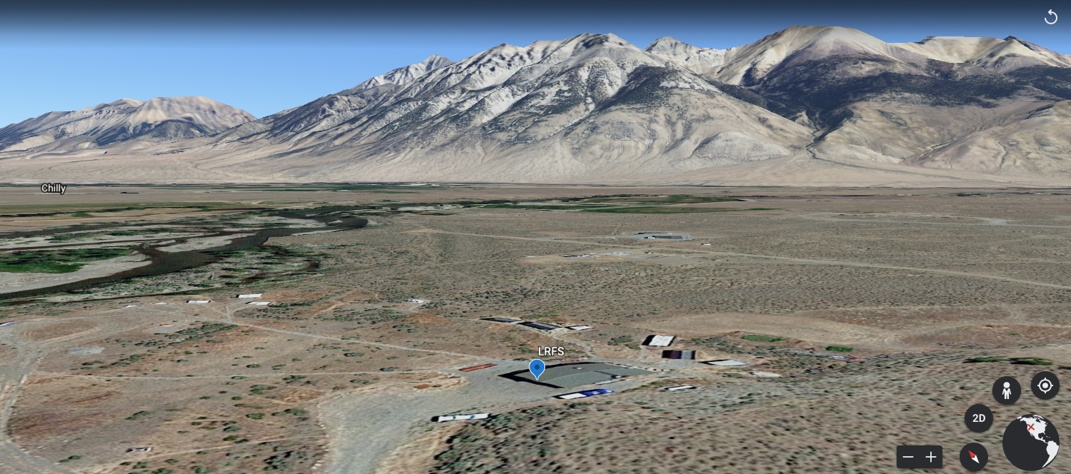
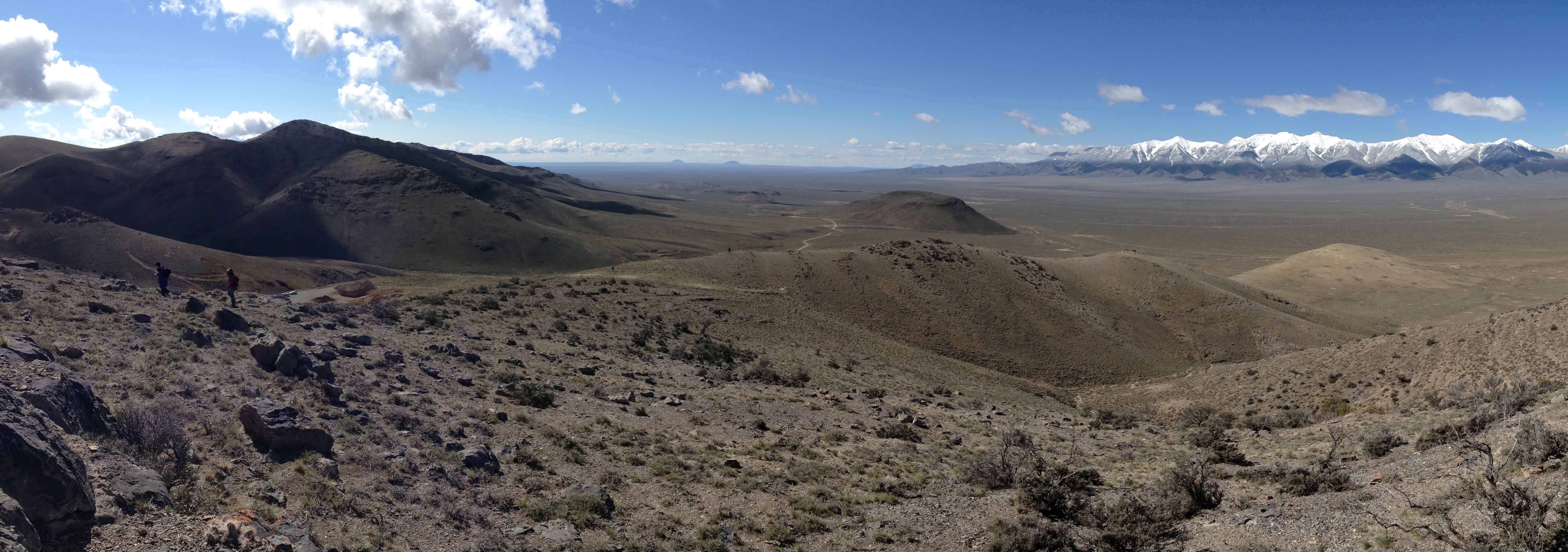
View westward toward the Lemhi Range from the southern Beaverhead Mountains, east-central Idaho.

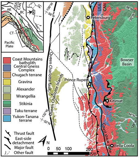
David Pearson Research in British Columbia, Canada

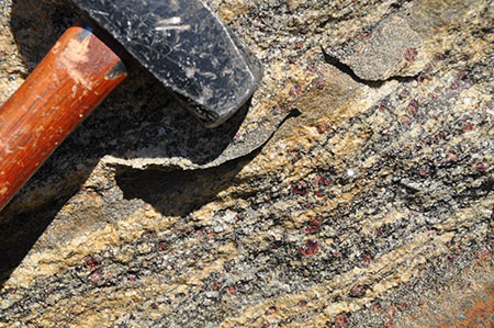
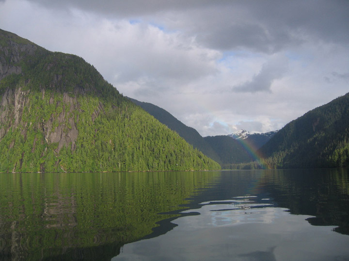
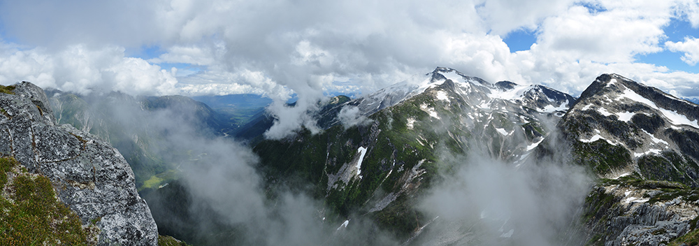
Peaks composed of syn-extensional Eocene plutons near the eastern boundary of the Central Gneiss Complex in the Coast Mountains of British Columbia

View Larger Map

View of high peaks in the Central Gneiss Complex of the Coast Mountains.

  • Current research applies a combination of field mapping and structural analysis, thermochronology, and metamorphic petrology to investigate the deformational history of amphibolite- and granulite-facies equivalent rocks in the Coast Mountains of British Columbia, Canada. Prior research was part of a larger project called BATHOLITHS, a collaborative study designed to better understand the formation of continental crust in the Coast Mountains Batholith in western British Columbia.


Overview map of western North American Cordillera showing retroarc fold-thrust belt, basement-involved structures in gray, major ~orogen-parallel strike-slip structures, and Jurassic to Eocene plutons of the magmatic arc (Pearson, in prep.; modified from Price, 1994; DeCelles, 2004; Wyld et al., 2006). Idaho State University (ISU; shown in blue) is favorably located to investigate many aspects of the ancient ocean-continent subduction system.

Index map showing Central Gneiss Complex, Coast shear zone, and other major tectonic features in western British Columbia (Pearson et al., 2017; modified from Rusmore et al., 2005; Gehrels et al., 2009).

Garnet porphyroblasts in a garnet-sillimanite-biotite gneiss in the Central Gneiss Complex. These rocks likely experienced mid-to lower crustal burial in Cretaceous time (Hollister, 1975), followed by rapid exhumation accomplished by low-angle detachment faulting during Eocene time (Andronicos et al., 2003; Rusmore et al., 2005).

Mussel Inlet, western British Columbia, Canada

Andes Research

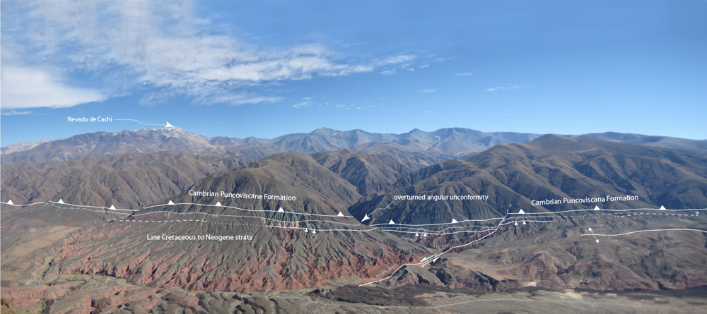
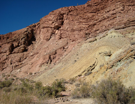
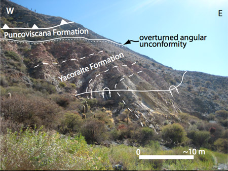
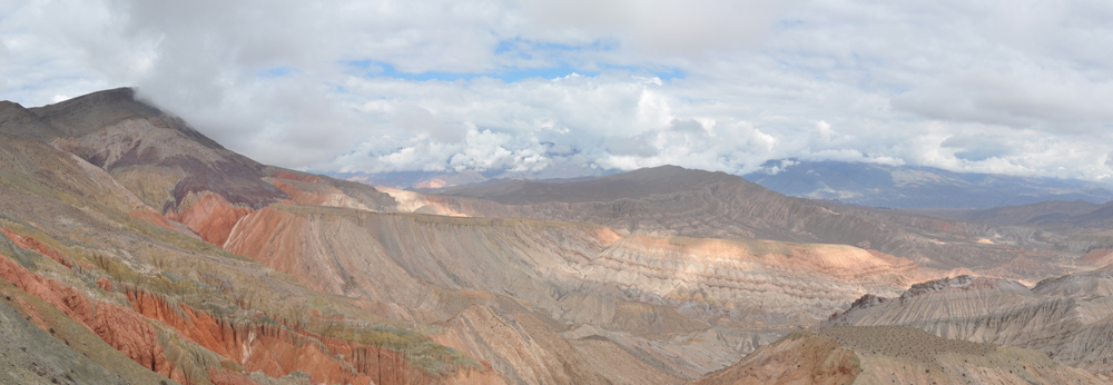
TECTONIC AND STRUCTURAL EVOLUTION OF THE SOUTHERN CENTRAL ANDES, NW ARGENTINA


View Larger Map

View toward NW of doubly-plunging Tin-tin anticline, east of Cachi. Explore the basement-involved fold-thrust belt of NW Argentina in Google Earth.

  • Current research applies a combination of geological mapping and structural analysis, thermochronology, and tectonics to understand crustal thickening in and the formation of the southern central Andes in northwestern Argentina. This research is part of a larger project called COSA (Convergent Orogenic Systems Analysis), a collaborative study designed to better understand continental orogenesis.


Panoramic view of northern Calchaqui Valley and Cachi Range near La Poma, Argentina. Structural relief in the Cachi Range is primarily a result of fault-propagation folding. The visible contact at the range margin is often an overturned angular unconformity.

Isoclinal folding within Cambrian Puncoviscana Formation metaturbidites likely occurred during mid to Late Cambrian time.

Sigma clasts and S-C fabrics occur within ultramylonitic shear zones in Ordovician granitoids in the core of the Cachi Range. This shear zone records a normal sense of displacement and may reflect extensional collapse of an Ordovician orogen.

This minor fault propagation fold south of La Poma accommodated ~30 m of reverse-sense structural relief.

Overturned angular unconformity in an overturned footwall syncline at the eastern margin of the Cachi Range. This is a thick-skinned style of deformation and, coupled with (U-Th)/He-zircon results, demonstrates that fault-propagation folding (not slip across discrete faults) was the major mechanism for the formation of structural relief in the region.

Panoramic view of Miocene growth syncline near Quebrada del Toro, west of Salta, Argentina.